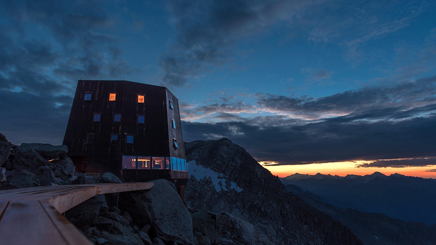
.jpg)
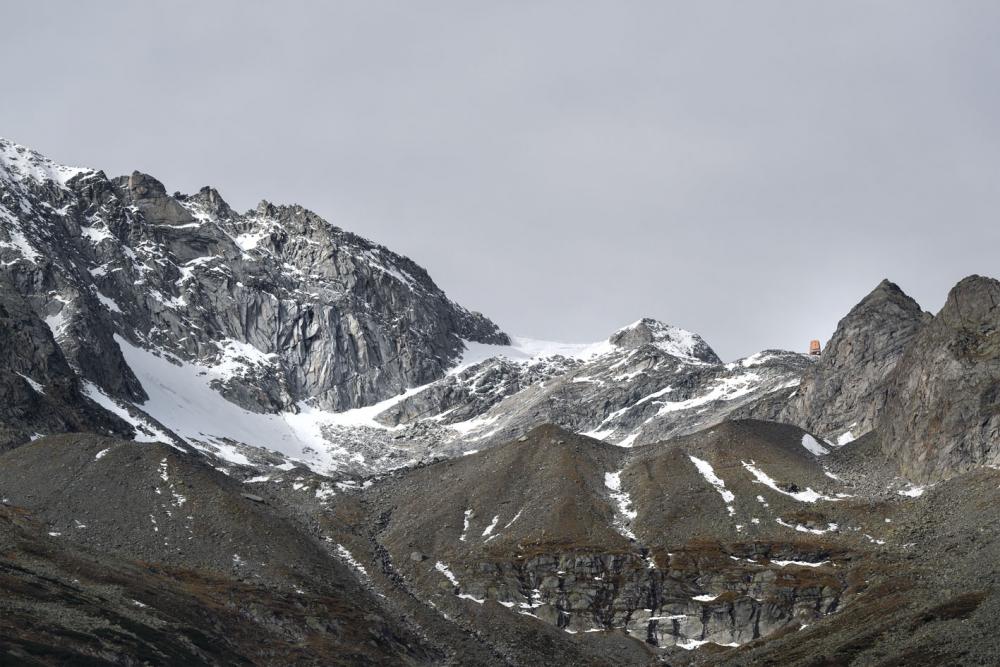
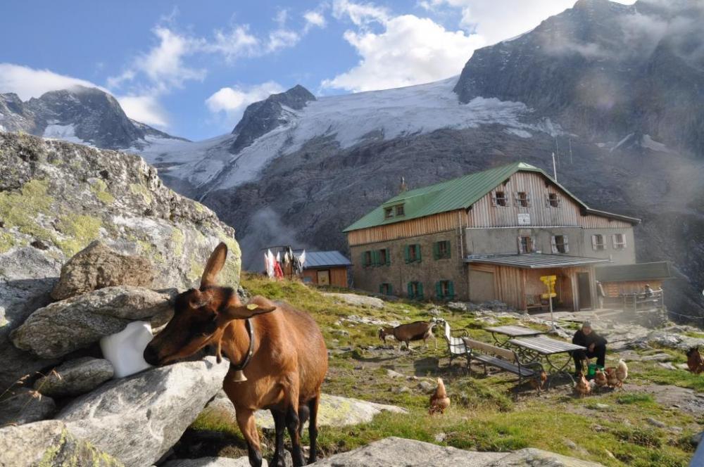
Shortly before the village center of St.Johann, turn left towards Gasthof Stallila (+1,472 m). There is the parking lot. From here you follow on footß the forest path to the Daimerhütte (+1,862 m). From now on you continue on path no. 23 in steep hairpin bends to the Rotbachkees (no glacier equipment required, mostly only firn). Follow the path to the end of the valley and then keep to the right. It continues over glacial slabs, secured with new steps and wire ropes. You can reach the Schwarzensteinhütte via this well-marked path. As a variant, you can descend via the Trippbachtal, past the Kegelgasslalm and the Russbachalm and take the forest path back to the car park.
ALTITUDE: approx. 1,550hm
WALK TIME: approx. 4.30h

From the Rotbachtal in St.Johann


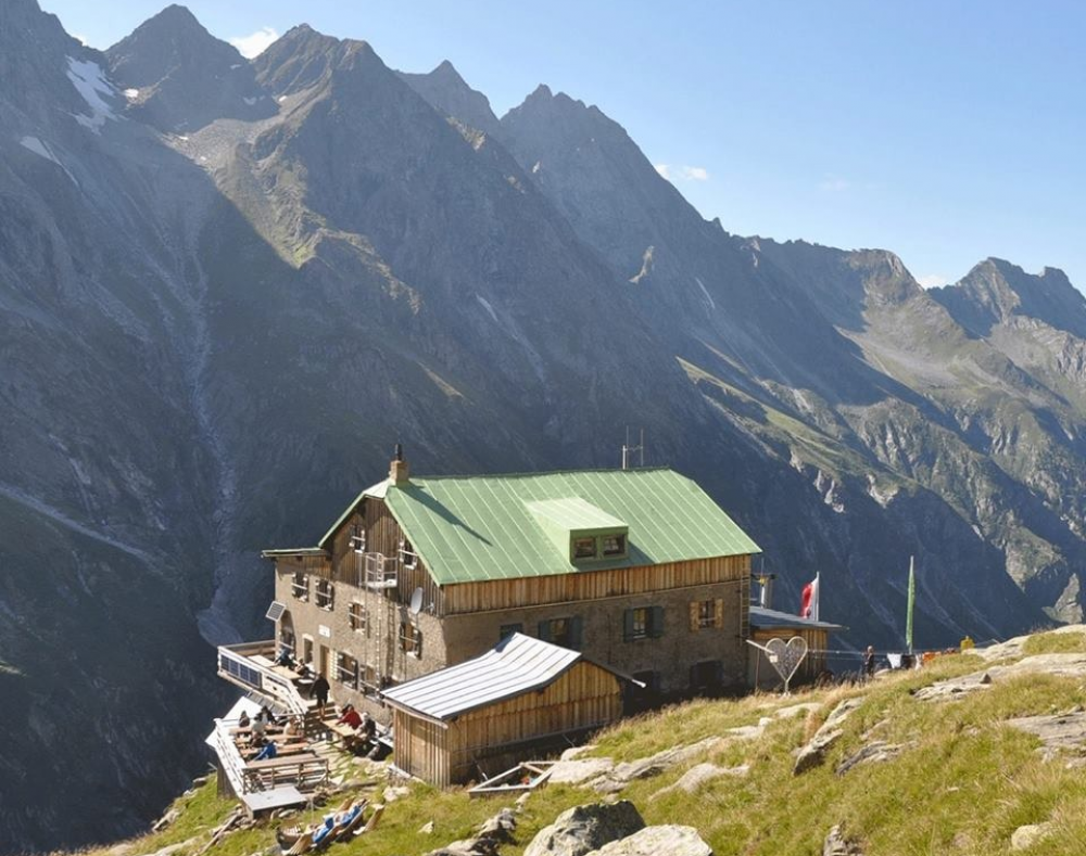
From the Trippbachtal in St.Johann
Shortly before the village center of St.Johann, turn left towards Gasthaus Stallila, after approx. 1km turn right towards Russbachhof. The parking lot is about 200m past the farm. For the ascent, follow path no. 19 to the Russbachalm and then on to the Kegelgasslalm (+2,109m, overnight stays may also be possible). From there it continues via the "Große Tor", which is followed by a short descent (approx. 150hm) into the Rotbachtal. Follow the path to the end of the valley and then keep to the right. It continues over glacial slabs, secured by new steps and wire ropes. You can reach the Schwarzensteinhütte via this well-marked path. A second variant of the ascent would be to climb from the Kegelgasslalm via the Trippbachkees to the Schwarzensteinhütte, but glacier equipment is required for this. When descending, you can also choose to descend via the Rotbachtal to the Gasthof Stallila and from there via the "Sunnsatweg" No.19b back to the parking lot.
ALTITUDE: approx. 1,700m
WALK TIME: approx. 5.30h
ALTITUDE: approx. 1,700m
WALK TIME: approx. 5.30h
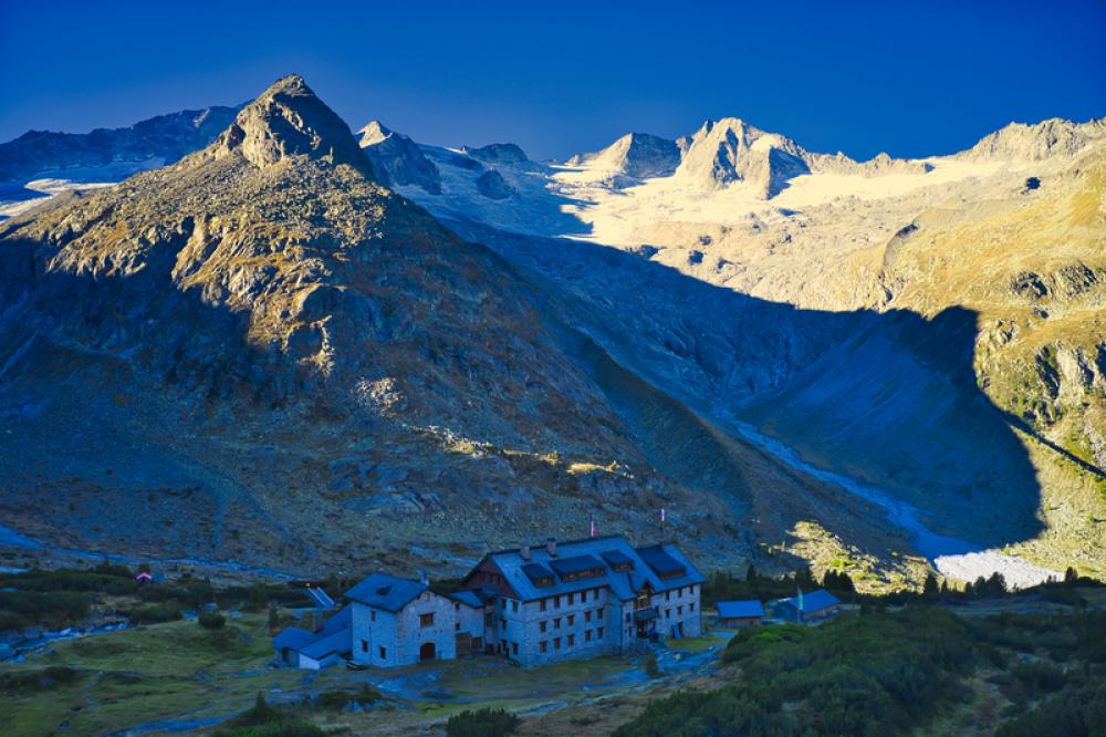
From the Greizerhütte in the Zillertal
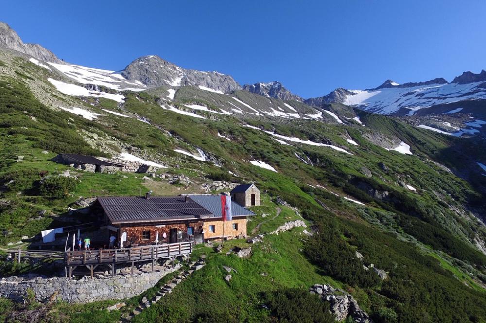
From the Greizerhütte, follow the Schwarzenstein signpost. No markings but cairns show the way. You should have a good sense of route on the polished rocks from the glacier. Climb high enough then cross the glacier. Find the way through the Floitenkees. Watch out for falling rocks and crevasses. Arrived at the Trippbachsattel, the Schwarzensteinhütte is already visible.
ALTITUDE: approx. 900hm
WALK TIME: approx. 3.30h
ALTITUDE: approx. 900hm
WALK TIME: approx. 3.30h
.jpg)
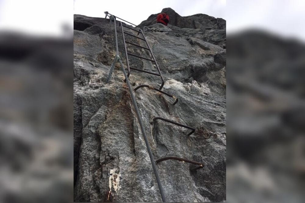
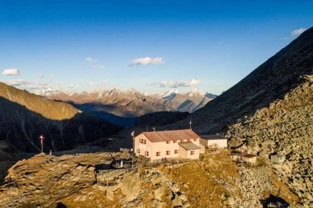
From the Berliner Hütte in the Zillertal
Northeast of the hut, follow the path towards Schwarzenstein. It leads partly through boulders. Arrived at the glacier, rope up and now go east towards Felskpfel, from there descend approx. 200hm. This tour can only be done with glacier equipment.
ALTITUDE: approx. 1,200hm
WALK TIME: approx. 4.30h
ALTITUDE: approx. 1,200hm
WALK TIME: approx. 4.30h
-chemnitzerhuette.jpg)
From the Chemnitzerhütte in Lappach
The so-called Stabeler Höhenweg is a high alpine trail. Route 24a is long and demanding. Some places are provided with wire ropes. This mountain tour is only recommended for experienced mountaineers in good physical condition.
ALTITUDE: approx. 1,300hm
WALK TIME: approx. 9.00h-11.00h
ALTITUDE: approx. 1,300hm
WALK TIME: approx. 9.00h-11.00h